May 13th 2011The invasion begins in earnest.They have marched into Scotland, Wales, Cumbria, Yorkshire, Lincolnshire andother counties as well, including Cornwall (although those first ones were pygmy turbines) Now the first five giant turbines are looming over our Devon hills (17 more to come) And that is just the beginning, if Chris Huhne, David Cameron, Nick Clegg, Ed Milliband and the EU get their way More photographs of the first Fullabrook Down Wind Turbines, plus a couple of short videos. |
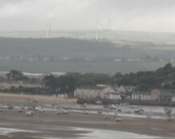 |
This first photograph was taken
on Friday morning, at about 8.30, through the window of a No 85C Bus
(Stagecoach) as it traveled over the River Torridge, on Bideford New
Bridge. It was drizzling, we
were moving fast, and visibility wasn't
great, but we could see the first five Fullabrook turbines
clearly.
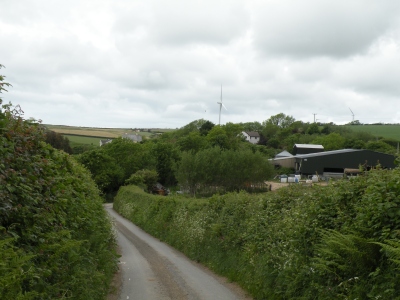
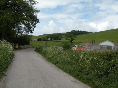
The village that you can see in the foreground is Instow, which is on the Torridge Estuary. Over the hill from Instow, you can see the glimmer of water in the Taw Estuary, and on the hills above it you can just make out a line of houses in the village of Heanton Punchardon. The turbines that you can see against the sky are several miles north of Heanton. Please note; larger and higher resolution versions of these photographs are available. |
 This photograph was taken at about 9 am, on Sticklepath Hill, in Barnstaple. If you look between the bungalows you can just see a crane (beside the tower of turbine number 6) on the horizon. |
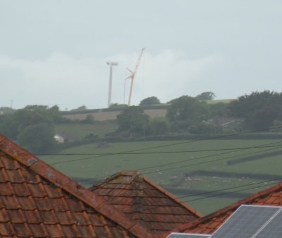 In the cropped close up taken
from the same photograph, above,
you can see a crane, and the tower and nacelle of Turbine No 6.
|
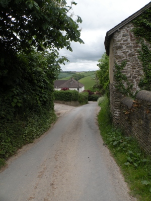
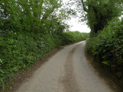 The next set of photographs were taken upon the hills, from about twelve o'clock onwards. This is a lane near Patsford. There were still bluebells in the hedge banks, but campions, stitchwort and cow parsley were taking over. All seemed peaceful... until we went a little further on. |
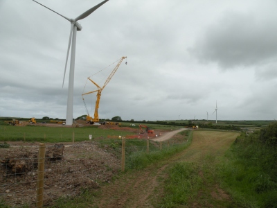
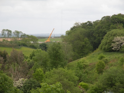
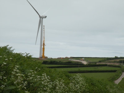 This was the sight straight ahead of us. This presumably is the crane that we had seen from Sticklepath Hill in Barnstaple, two or three hours earlier, and perhaps 7 miles away. The turbine is no 6. The long vehicle that you can see is close to Beara Cross. Link to map showing turbine sites with turbine numbers. |
 This is the site of Turbine 10 - you can see the waiting blades, and part of a nacelle. (The turbine behind it is probably Turbine 11, some way further back.) The photograph was taken from the road. Yet again, it is worth mentioning the fact that these turbines are very close to roads, footpaths and houses, and this can be dangerous, as mentioned on previous pages. This is a link to a video about ice-throw: |
 This is just by Beara Cross,
after a lorry had passed us. You can still
see the dust in the air. All this construction has caused damage, not
only to people's lives, but to wildlife. While out walking we met
a local who told us a sad tale about some larks that had been displaced
from their normal nesting
sites. They had moved to a different field, that they must have thought
was safe: and then the farmer cut the grass where they were nesting.
|
Here a couple of short videos. The first shows the site of Turbine 10 again, and then looks back towards the road beside the field. This link shows what can happen when a wind turbine goes out of control and blades are thrown - often a long distance. And here is a link to another video about ice throw. Perhaps you can see why many people feel that turbines should not be situated anywhere close to houses, roads or public rights of way. |
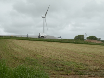
This is a very short video
showing Turbine 6. If you look at it in Full
Screen you may get a better idea of its size (110m, 360 ft)
Many of these turbines will be close to houses: here is a link to betterplan.squarespace.com where you can read first hand reports of what it is like for residents who live close to a wind farm, and for some farmers who lease their land for turbines and begin to regret it. |
 This is turbine 6, from a closer viewpoint. unfortunately, none of these small photographs can give a real feeling of the monstrous height of these turbines. (link to map again) |
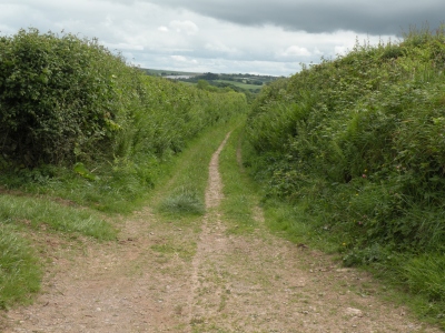 By contrast, a view up a small
and untouched green lane.
|
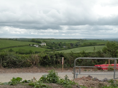 Looking across towards the hamlet of Beara, with Dartmoor in the distance. |
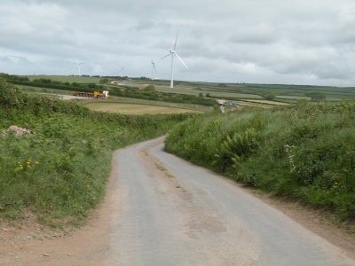 Looking back towards Beara Cross,
all five turbines visible. No sign -
beneath the rubble - of the
orchids that usually bloom on the bank here at the side of this road.
|
 Looking across the valley, at Beara. |
 Looking back at Beara. |
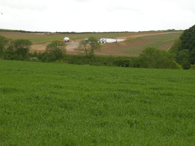 Looking across from near Pippacott at the site of Turbine 5, which will be above one of the most secluded valleys on these hills. Here is a link to a page about a walk I did back in 2006, that went through the valley. |
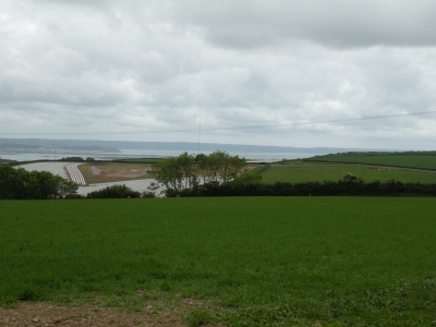 Looking across at the site of Turbine 7, the southernmost turbine. You can see Bideford Bay, and the cliffs towards Clovelley and Hartland, in the distance. Link to map |
 A view through the little hamlet of Pippacott. |
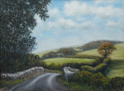
 Approaching Knowlwater Bridge,
the site of my painting.
The
sub-station
is
to
the
right.
This sub-station is indeed a blot on what was once such a sweet landscape. You could call it Devon's own "Hub" - small in scale for now, but we are a few years behind Wales in wind turbine penetration. |
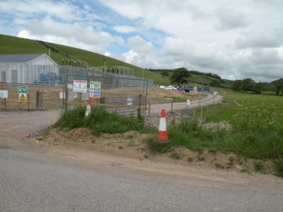
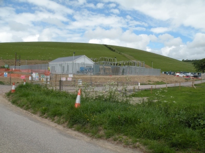 Two more views of the sub-station (above and right). This (and the damage to the hills above) has only been allowed in order to meet government targets for renewable energy (targets that will do nothing to halt global warming but serve only to act as fig-leaf when nothing serious is being done to reduce our CO2 emissions or provide energy security) |
 Make no mistake - while we have
three party leaders all in favour of wind power (although many of their
MPS support campaigns against it) this is just the beginning. Why
else would they be opening factories making more and more
turbines?
That is the most disturbing news of all, especially as a study has
shown that for every Green
job created, 2.2 jobs are lost.
|