|
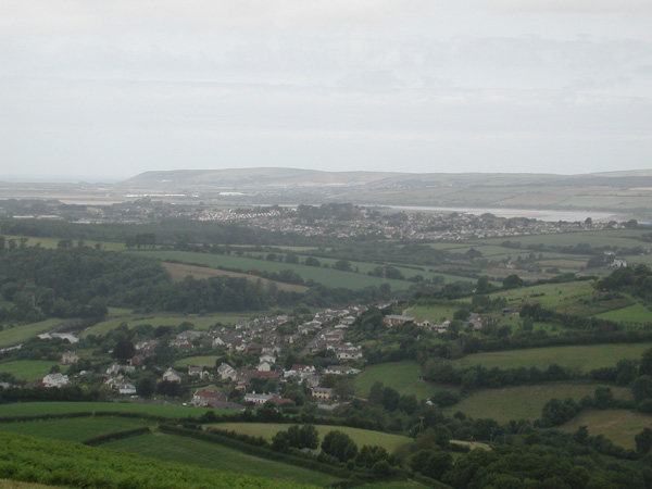
This
is the view towards
Braunton and Saunton, from Codden
Hill, one of the best
loved hills
in North Devon, which is to the south east of Barnstaple. In this
photo, you can see the woods on the hill at Ash Down where I
stood at the site of
turbine 8 - if you look
vertically up from the middle of the word "the"
that is underlined in
the text above, you will
probably be about in the right place. Further to the west, you
can see buildings at Braunton and I think Chivenor Air Base, then
and above them in the photo, where the land meets the sea,
Saunton Down, you can just glimpse the white shape of the Saunton
Sands Hotel. To get an idea of scale, the yellowish field on the hill
at right of the photo, just below the wood, is I think at a height of
about 90m (smaller than the height of the turbines) and the point where
Saunton Down drops into the sea is about ten or eleven miles away from
where I stood - as the crow flies... although much farther by
road of course. Here
is a link to multimap, showing the whole area (the circle is on
Bishops Tawton, and Codden hill is just to the right of the village on
the map. You can zoom in for a better view.) 2008 Nov: more turbines proposed on the
hills above Yelland, between Fremington and Instow) to left of this
photo, not quite in the photograph
|
|
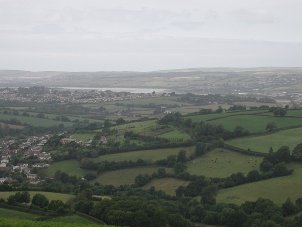
This photo was taken looking
across the estuary towards the main part of the Fullabrook site. You
can see Bishops Tawton below and I think that is the Roundswell
part of Barnstaple on the hill in front of the Taw. The yellowish field
that I pointed out above is now in the centre of the photo, and you can
see the higher range of hills behind and to the right where more of the
turbines will be. The point to
grasp about the size of the turbines is that they will be 110m high, on
top of these hills, while that field is less than 100m above the water
of the estuary.
|
|
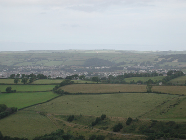
This
photo look across
Barnstaple (in the valley beyond the foreground hill). You can see
Tutshill Woods, close to where I live, and the subject of many of my
paintings, in the centre. To the
right of it is North Devon
District
Hospital. On the left hand side of the photo are the hills around
Marwood, (the eastern part of the Fullabrook Wind Power Station
site.) Tutshill Woods are 108m at their highest point, still not quite
as tall as one of the turbines.
|
|
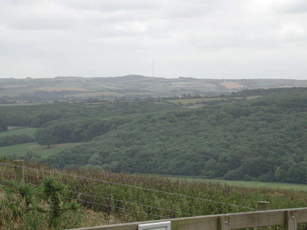
Looking
south east towards
Torrington, you can see the radio mast at Huntshaw Cross. Close by is
the site of the three turbines at Darracott Reservoir.
We did not walk to the far end
of the hill, but if the turbines are
built around Knowstone and Rose Ash, no doubt they too would be visible
from Codden Hill. I am not sure whether the turbines proposed for
Morwenstow and Parkham would also be visible from here as they may be
hidden by an intervening hill that is closer by.
Just a further note regarding the future - new proposals are coming in
thick and first, and the government are changing the rules so that it
will be harder than ever for local people to fight against them. And
the turbines keep getting bigger, Bradworthy turbines are just 75m (246
ft) tall, Fullabrook turbines are 110m (361ft), the ones proposed to
the south of Torrington, at Chilla Moor and Brandis Corner are 125m
(around 410 ft high)...
If you want to think about what it is like living close to one (as many
people will do) go this page on www.rawdenbydale.co.uk , and then listen to the noise of a
turbine in Aberdeendshire on www.wind-watch.org
Christine Lovelock June
30th 2008
back
|